
Calcasieu Parish ZIP Coverage
The only broad official ZIP map located in the research is a historical Louisiana Department of Health planning map from the 2007 era. The groups below are leads from that map and observed government mailing addresses, not a claim that each present USPS boundary is unchanged. The USPS ZIP Code Lookup remains the current check for one complete address.
| ZIP or group | Observed area | Postal context | Verification note |
|---|---|---|---|
| 70601, 70602 | Lake Charles | 70602 appears in official PO Box addresses | Check street delivery versus PO Box |
| 70605, 70607, 70609 | South or east Lake Charles and Prien labels | Historical map association | City limit and service area may differ |
| 70611, 70615 | North Lake Charles and Moss Bluff labels | Historical map association | Current street coverage not confirmed |
| 70633, 70647 | DeQuincy and Iowa | Municipal names independently confirmed | Verify each street with USPS |
| 70663, 70665 | Sulphur and Carlyss area | 70663 appears on a Clerk office page | Do not infer city limits from ZIP |
| 70668, 70669 | Vinton and Westlake | Municipal names independently confirmed | Check parish-edge overlap |
| 70549, 70591 and rural 706 codes | Parish-edge or rural labels | May cross parish lines | Confirm post office and parish portion |
No current official export of every parish ZIP, ZIP+4 range, post office, or multi-parish segment was found. A precise ZIP code directory therefore pairs this research list with an address-level USPS result instead of presenting the historical layer as a final boundary file.
Calcasieu ZIP Map Limits
The 2007 LDH map is a useful time capsule. It helps identify codes that may have served Lake Charles, Prien, Moss Bluff, Bell City, and rural parish edges, but it cannot settle today's delivery assignment. The May 2025 DOTD parish map is newer and shows roads, municipalities, township and range lines, and the parish boundary. It expressly is not a survey, and it does not define postal boundaries.
Use the two maps for different tasks. The historical ZIP layer suggests a code to test. The DOTD map helps orient a road or community within Calcasieu Parish. USPS confirms the current postal result for the full address, while parish GIS and the Assessor establish parcel and situs context. This layered method is slower than trusting a shaded map, but it avoids attaching the wrong city or parish to a resident record.
Search Calcasieu Residents by ZIP
Only some official tools accept a postal code. The Louisiana voter name form uses ZIP as one identity field, and its address form begins with ZIP. Neither form is a free household export. Protected records may also be suppressed. The parish parcel tools work from an address or parcel identifier instead of a ZIP filter.
- Enter the full street address in USPS Lookup and save the returned city, state, and ZIP without changing the original text.
- For a named person, use the Louisiana voter form with first name, last name, ZIP, birth month, and birth year.
- For one address, use the voter address form with ZIP, street, apartment or lot, and city.
- Carry the street into the Assessor search, then compare its physical address and mailing address.
- Once the postal area narrows the work, use the Calcasieu Parish street directory method for a street-level search.
A ZIP match is a starting filter. It does not prove that two people share a neighborhood, ward, precinct, or legal municipality.
Calcasieu ZIP Search Fields
The Louisiana Secretary of State Voter Portal offers name, parish, and address routes. Use the route that matches the known fact. Supplying fewer accurate facts is better than forcing a city label copied from an old map.
| Portal route | Fields observed | Best use |
|---|---|---|
| Voter name lookup | First name, last name, ZIP, birth month, birth year | Distinguish one registration result |
| Voter address lookup | ZIP, street address, apartment or lot, city | Check one complete address |
| Voter parish lookup | Parish selector, including Calcasieu value 11 | Registration and polling context |
| USPS lookup | Full address and city/state, or ZIP-to-city | Normalize current mailing data |
Louisiana law controls public voter-file fields and protected details. A paid list request can use chosen geography under Election Code rules, but the public single-address form is not a block directory. Keep the lookup date because registration and postal data can change.
Calcasieu GIS Postal Bridge
The Calcasieu Parish GIS and Assessor systems provide the land-side check after postal verification. The public parcel schema exposes fields such as PIN, owner name, mailing address, physical address, ward, zoning, assessment data, and geometry. It does not expose a ZIP field in the inspected schema. The Assessor form likewise offers parcel address, section, township, range, subdivision, and legal-description modes, but no visible ZIP filter.
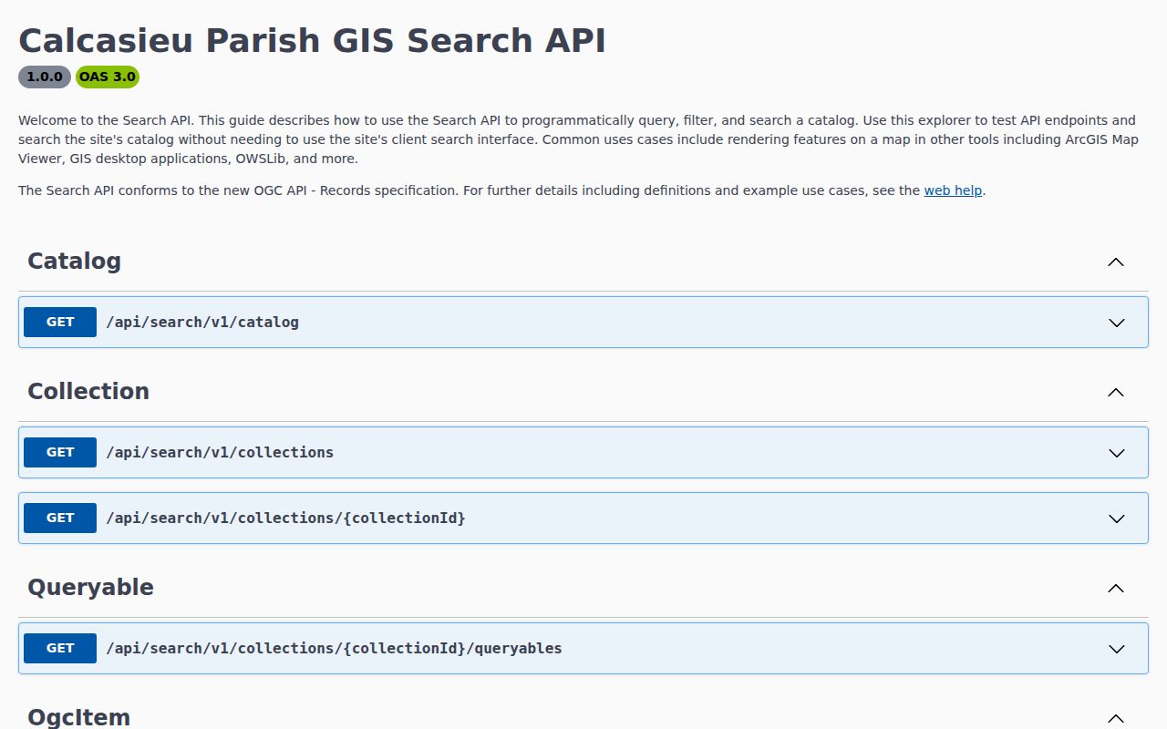
The Calcasieu GIS Search API definition documents catalog, collection, queryable, and item endpoints used by the parish search service.
Use PIN, the parcel identification number, as the steady bridge when mailing and physical addresses differ. A rural parcel may be easier to locate by section, township, range, subdivision, or legal description than by postal city.
Calcasieu Place Names Matter
Calcasieu Parish records use several kinds of place labels. Lake Charles, Sulphur, Westlake, DeQuincy, Iowa, and Vinton are incorporated places. Moss Bluff, Carlyss, Prien, Gillis, and Mossville are recognized community or place terms that can still appear in mailing, archive, map, or local-history records.
Preserve the label printed by each source. A voter result may use a postal city, an Assessor card a physical address, and a historical directory an older town or street form. None should be silently overwritten by the modern label. For rural searches, note the legal description and township-range location before linking a parcel to a name. Calcasieu Parish covers more than a thousand square miles, so a single ZIP can be a poor substitute for exact map geometry.
Calcasieu ZIPs Versus City Limits
Postal delivery areas are designed for mail. Municipal lines define local government. Wards and precincts organize other public functions, while parcel boundaries describe land. ZIP Code Tabulation Areas are Census approximations and are not USPS delivery routes. These shapes can overlap without agreeing.
- ZIP code
- A USPS delivery code attached to an address, not a legal city boundary.
- ZIP+4
- An added four digits that narrow delivery to a smaller segment, building, or group of boxes.
- PO-box ZIP
- A code or use associated with post-office boxes rather than a street-delivery area.
- Unique ZIP
- A code assigned to one high-volume organization. No current Calcasieu example was confirmed.
- Carrier route
- A set of delivery points assigned to a mail carrier, distinct from a neighborhood or ward.
This mismatch explains why a Lake Charles postal address can fall outside Lake Charles city limits, or why a community term remains useful even without municipal status. The Calcasieu Parish ZIP code directory should narrow the search, never settle legal jurisdiction by itself.
Verify Calcasieu Postal Results
A sound ZIP code directory citation records both source and date. Save the complete address submitted to USPS, the returned city and code, and any apartment or lot text. Then save the parcel PIN or physical address from the parish source. If the two disagree, do not choose one at random. They answer different questions.
For an older address, retain its original spelling and directional prefix before normalizing a copy. Compare the historical LDH map, current USPS result, DOTD road context, and GIS parcel. If no match appears, test a community label such as Moss Bluff or Carlyss and search by legal land fields. No public official crosswalk was found connecting all current ZIPs to Calcasieu wards, precincts, municipalities, fire districts, and school zones. Each custodian must be checked for its own geography.
That caution keeps a postal hint useful without turning it into a claim about residence. A Calcasieu Parish ZIP code directory is strongest when every step remains traceable.